Evolution of my Maps
I’ve been asked to show some fellow writers my hand drawn maps, so I thought I would post the evolution of The Lowest Realm’s maps.
I started writing TLR about 17 years ago, and at the time I was good at drawing maps, but only on a basic level.
To counter this, I painstakingly used paint with an ordinary mouse to recrate the outline of my maps. I had in my mind that it would look amazing, but in all honesty it was quite crap.

I also made a mockup with terrain for some reason. At the time I thought they were cool.
The Roman numerals indicate that I hadn’t thought of names for regions. A lot of the place names for things are Dutch words as I was learning Dutch at the time. A lot of these names have since changed.

When I revisited the work 17 years later, I knew I needed to fix the maps and bring them up to date. I signed up to Inkarnate and once again recreated the maps.


I love the look of Inkarnate, but they are impractical for my book. The bright colours make it look very dark when printed in black and white.
And so I bought Wonderdraft, and dabbled in their software. I like the platform, but wasn’t happy with the look. Plus I couldn’t get the sizing of the assets right.

I think at this point I threw my hands up in despair and said ‘fk this!’
In my world, there are no computers or digital maps, so it made sense to go back to the start and redraw them.

To do this, I traced the printed maps to preserve the coastline, using 0.2mm fine liners on high quality art paper.


I liked this a lot, it just needs some edits. This I did in paint.

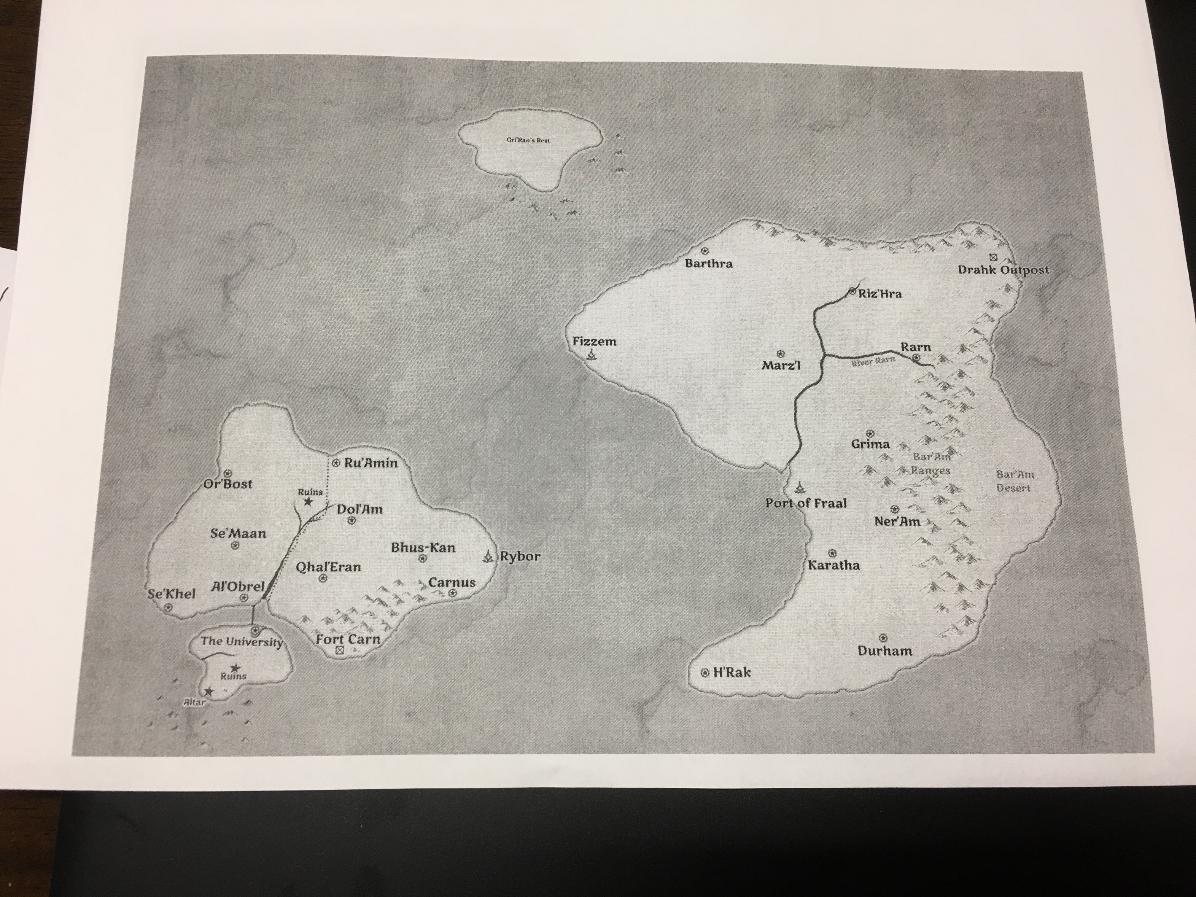
Here is the Isle Bar’Am. It was almost ready to publish….but still not 100% happy with it. So I’ll be adding some coastlines.
I plan to erase the inside content, and overlay the coastlines onto the edited copy.

Since I am now working on book 2, I needed to expand my world map. I enlarged one of the continents using word and a printer, and pencilled in some basic details. This continent is half a world, so the details will be very basic. I will do zoomed-in higher detailed maps for each area later on.
Evolution of my Maps
The Noughties
I drew the maps for The Lowest Realm in the year 2000 when digital technology was still a new concept. The school computers were still running Photoshop 5.0 which was still quite basic at the time. Since only the art students were taught how to use it, I opted to use Microsoft Paint in all its glory. Pixel by pixel, I clicked those tiny little squares that only appeared at max zoom, and recreated the map by hand.
The early mice weren’t the smooth lasers we have now. Back then, we had those boring grey mice with the little ball underneath that was always clogged with hair and grime. It took forever, but eventually I managed to get the coast and cities to exactly how they were on paper.
I also made a coloured version to show the terrain. At the time I thought they were cool.
At the time I hadn’t thought of names for regions. It was supposed to be a world map, but as you will see, they eventually became the Eastern Isles. A lot of the original place names were Dutch words as I was learning the language at the time. Most of these names have since changed.
Random fact: After making the colour file, I tried to save it as a .BMP file on my 1.44mb 3.5″ floppy disc, only to receive the error that the disc didn’t have enough space. Then, when I tried to save as a .JPG instead, the colours were distorted and my hours of work were for nothing. I had to redo the entire thing!
Seventeen Years Later
I started writing The Lowest Realm (previously Death of Thy World) in 2000 for my year 10 Private Studies class. The original hand-drawn map was submitted with the prologue and first chapter. After it was submitted, I put the project aside and didn’t touch it for seventeen years. Over those years, the only files I transferred to newer media was that original Word doc and the two map files.
In 2019, I was talking about the story to my mother inlaw and decided to pull it off my dusty hard drive and see if I could still use it. It opened on my older version of Word and the images displayed alright. It was a big win! I wrote the entire novel and realised I would have to re-draw the maps in an updated style.
I decided to try a website called Inkarnate and once again spent hours on getting the coastline as close to the original as possible (I have legit OCD so they absolutely had to match). Below are the two maps I created using the site. The downside was the colour – when converted to grey scale, the images were too dark to look good on paper.
It was back to the planning board.
I was quite frustrated, but I’m not a quitter. I purchased Wonderdraft, a standalone product for creating maps. With this software I was able to import files to create the coasts and there were some great features. Unfortunately, I had the same issue of the colours not playing nicely on paper. I tested a number of different themes, but things just weren’t playing nicely.
I think at this point I threw my hands up in despair and swore loudly. There was no other way to do it. I was going to have to draw it by hand and do a high res scan for the book interior. Maps are penned by hand in my fantasy world so it made sense to do them myself.
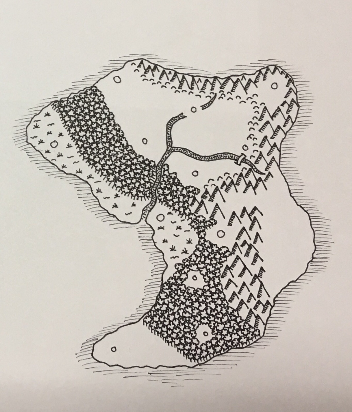
At the time I didn’t have an iPad or a light box so I had to improvise. I used a small aquarium light, a sheet of glass, and created my own so that I could once again trace my coast.
It took a few modifications to be able to see the coastline properly through the paper. I ended up drawing the coast on a print out with a fine tip marker so that I could see it well enough to trace. Why didn’t I use a scanner? Because I had no idea what I was doing and it just wasn’t ‘right’.
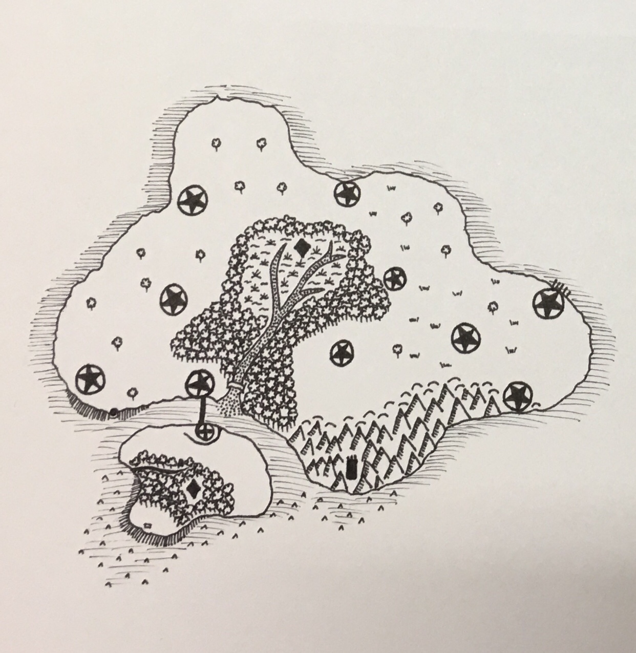
This was my first attempt and despite a few ugly bits, I was quite happy with it. I wasn’t a fan of the city icons, random little trees, and the grass, so after successfully scanning it, it was back to Paint to touch it up. I did experiment with different ways to pretty up the coast, as you can see below on the test page.

Here is the first published version of the isle now named Bar’Am. You can see that I used software to do the city icons and text. I did manage to draw the little boat myself! As much as I was proud of myself for doing it myself, I still wasn’t in love with it and knew I could do better.
2021 – Back to Digital
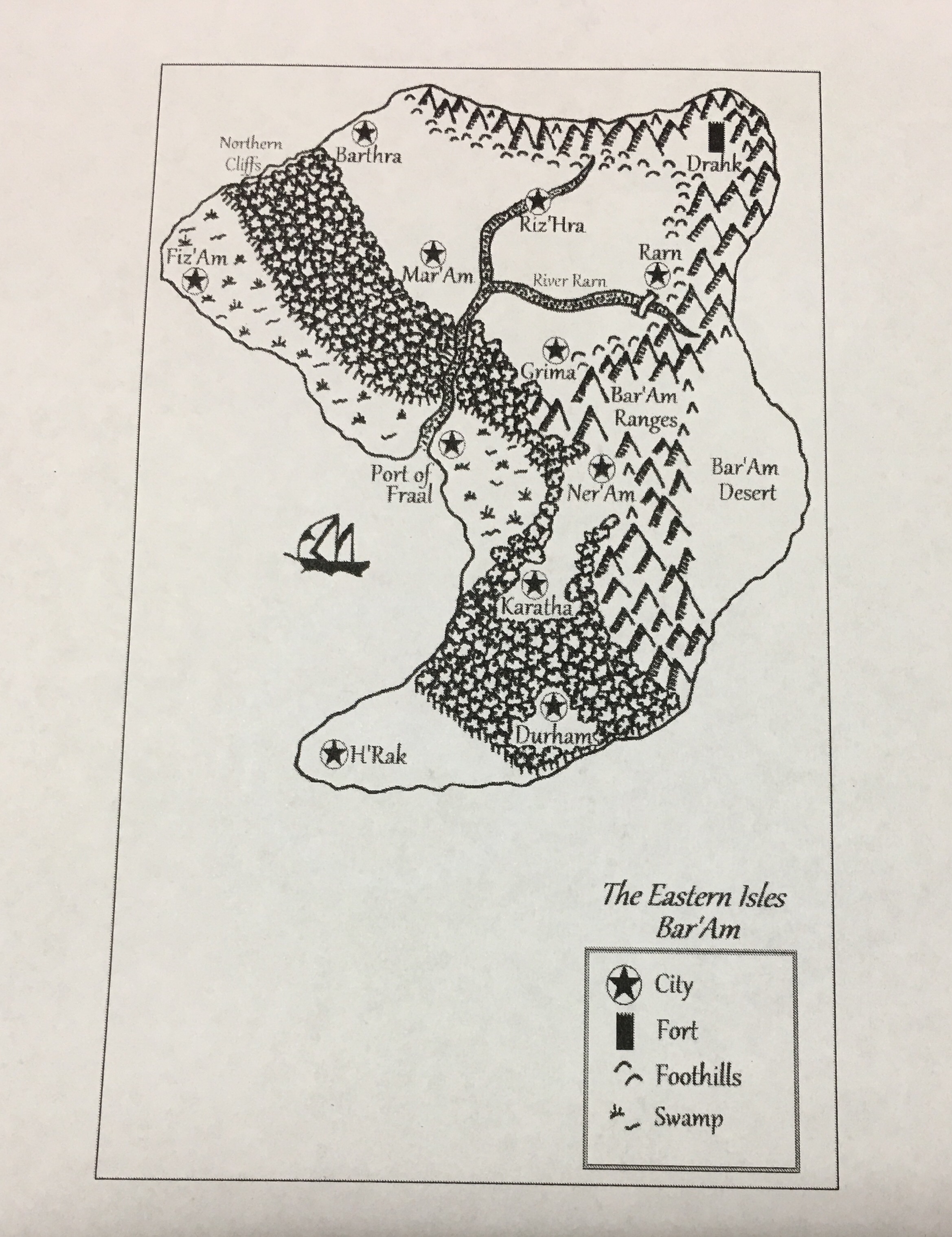
During Covid and lockdown, I worked on a reprint of The Lowest Realm and decided it was time for new maps. I bit the bullet and purchased ProCreate for my iPad as well as an Apple Pencil and got to work. Drawing on a tablet was definitely out of my comfort zone but I persisted. I learnt how to import, use layers, and trace. Thanks to YouTube, I was able to teach myself how to use this amazing technology. The maps below featured in the second print run, albeit with a lighter ocean as this original colour was too dark. At least I was able to change the colour with minimal effort!


An Expansion!
In 2022 I released book 2, The Darkest Realm. Since the story was no longer based on the Eastern Isles, I had a new dilemma – I had to create an entire new map! I tried a few things but really struggled to get it right. The below map is A1 size and still hangs by my map desk, but after deciding that it looks like an angry genie, I discarded it.

I fell in love with this finished map (which also required changing the water colour) and this is the map I use today albeit with a few minor modifications. I’ve also created stand-alone maps for Lorendia, Maikaden and Gri’Ran’s Gate, and for book 3 will be making 3 new maps for whichever kingdoms my heroes travel to. No spoilers!
2023 – 23 Years Later!
Now, after 23 years since penning that very first map and clicking all those tiny pixels, I have once again levelled up my skills and given the maps a touch up. I’ve discovered new tricks and have honed my skills a lot thanks to my TikTok journey. Below you will see the latest updated maps as of Feb 2023 which are contained in the latest print runs of The Lowest Realm (2nd ed) and The Darkest Realm.


I’m so proud of my own journey when it comes to my cartography. You can see my growth as an inexperienced teen to becoming an artist, a title I’ve only recently decided to embrace. Will this be the last time I draw these maps? Maybe? Maybe not. The biggest challenge I face now is drawing the three new maps in the same style as these ones so they all look consistent. If not…this post will be updated again a year or two from now.
For more mappy goodness, check out my TikTok account.
Thanks so much for joining me on this crazy journey.
Much love,
Amex ❤
Last updated: 10 March 2023. All images (C) Amy-Alex Campbell.

Leave a comment